| Joland Jǫðveldi Jolands
| |
|---|---|
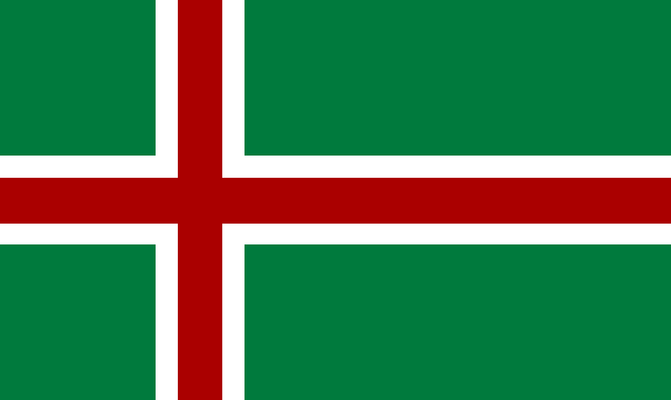 Flag | |
|
Motto: "Øn Ey, Øn Jǫð" One Island, One Nation | |
|
Anthem: "Ey Sangr" Island Song | |
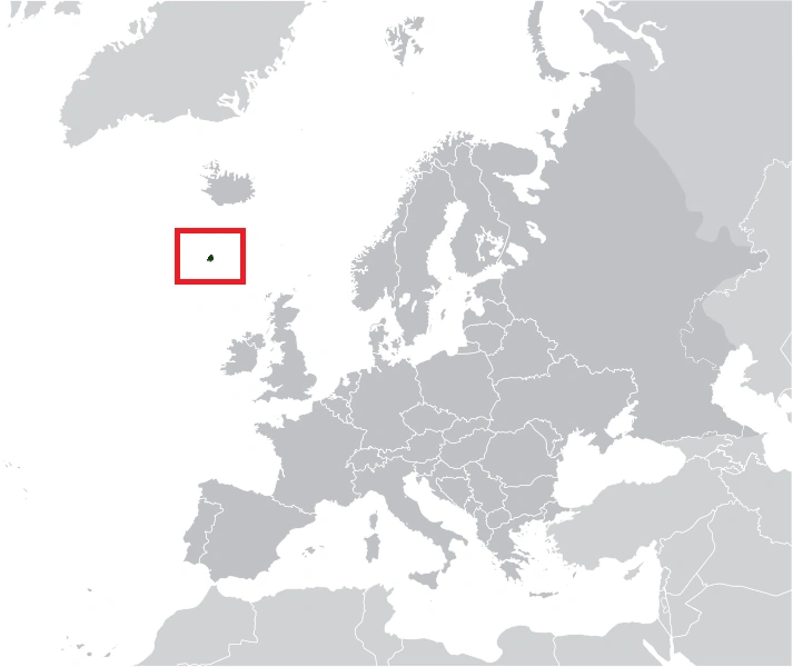 Location of Joland in Europe | |
| Capital | Lųnvibyg (de facto) |
| Official languages | Jolandic |
| Demonym | Jolandic |
| Government | |
• President |
Johannes Ǫflegr |
• Prime Minister |
Sigmųn Gørvolgr |
| Legislature | Eyþing |
| Establishment | |
• Independence from Norway |
1924 |
| Area | |
• Total |
47 km2 (18 sq mi) |
| Population | |
• Census |
11,365 (2014) |
• Density |
240/km2 (621.6/sq mi) |
| GDP (PPP) | 2014 estimate |
• Total |
$350 Million |
• Per capita |
$30,769 |
| HDI |
0.906 very high |
| Currency | Jolandic Krona (JOK) |
| Time zone | GMT |
• Summer (DST) |
(UTC+1) |
| Drives on the | right |
| Internet TLD | .jo |
|
Website www.jothveldijolands.jo | |
Joland, officially referred to as the Republic of Joland (Jolandic: Joðveldi Jǫlands), is a small island country located in the North Atlantic Ocean, roughly 487 Kilometres South of Iceland. Joland is a volcanic island, that has a total area of just over 47 km squared, and a total population of just over 11,365. The de facto capital is Lųnvibyg. Joland is the 5th smallest soveriegn state in the world.
The island was settled by Vikings from Denmark in the 8th century, roughly around 878. The island was discovered on the Eve of Yule (Jol), and was named accordingly. However, the island and its roughly, 400 inhabitants were cutoff from the outside world for many decades due to the loss of the island by the Vikings. The harsh environment led to the death of many of the colonists of the island. Colonists survived on eating Fish, and Puffins. The island was later discovered by fisherman and sailors from Norway and Denmark. Joland was later part of the Kingdom of Denmark again, until 1940, when Denmark was invaded by Nazi Germany, the island, alongside Iceland came under Allied Occupation. Allied Occupation ended in 1947, and the island came under trusteeship of Iceland until 1953 when it became fully independent.
Joland is a Parliamentary Republic, in which the President is the ceremonial Head of State and the Prime Minister is the Head of Government and has most of the political power, however sovereign power is excercised by the Parliament of Joland, the Eyþing. Politically, Joland has a culture of high democratic participation, and proportional representation. The island, and state as a whole, scores very highly on quality of life indexes, including civil liberties, income, freedom of press, and democracy. Joland is a highly liberal country, particularly in regards to civil liberties, particularly LGBT Rights. There has never been a law making it illegal to be gay in Joland.
Joland today is a developed island nation, with a unique cultural heritage and language which are a remaining characteristic of its long isolation. The island's main economic activities are Fishing, Tourism, and Service Sectors. Joland islanders are very self sufficient as a people, and have a culture of non-violence towards each other, aswell as a culturally inbult sense of community as a product of the island's very low population and small size and long survival in a harsh environment together. Joland is generally irreligious, with just under 20% of the population claiming to be affiliated with a religious organisation. There are only two churchs on the island.
Etymology[]
The name "Joland" originates from the Old Norse word, "Jol" meaning Yule. The island itself was discovered during Yule in 878, and was named accordingly. Since then, the island has been referred to as either Joland, or Juland, and rarely, Joley (meaning Yule Island). The common endonym for Joland is also the exonym, while the official endonym is Jǫðveldi Jolands (Republic of Joland).
History[]
Geography[]
The island of Joland has a total land area of 47 km squared, making it one of the smallest sovereign states in Europe. It takes a total of One and a Half hours to drive around the island at average speed. Joland is a volcanic island, located in the North Atlantic Ocean just East of the Mid-Atlantic Ridge. The island is almost entirely made of Igneous Rock erupted from the Jol Volcano roughly 6,000 years ago.
The island was formed by a volcanic eruption roughly 6,000 years ago. The remains of the volcano are located in the northern portion of the round island, otherwise the island is mostly flat. Urbanised areas are located around the edge of the island, and almost span the island's entire coastline. The inland of the island is almost entirely deserted due to its hilly nature. The island is designated as having the hardiness rating of 5-6, (3 being the most hardy and barren), meaning plantlife stuggles to grow on the island. Much of the biodiversity is located around the island's coastline.
The last volcanic eruption in the island was estimated to be during the early 8th century, before the Vikings discovered the island in 878. The eruption created a large amount of the southern part of the island adding significant land area.
Climate[]
Joland has an Subarctic Maritime Climate, experiencing Cool Summers and Cold Winters. Summer Maximum temperatures rarely reach higher than 19 Degrees Celsius, and Minium temperatures are usually around 4-5 Degrees Celsius. In Winter, temperatures drop to a minium of -9 Degrees Celsius, while Maximum Winter Temperatures are around 2 to 3 Degrees Celsius.
Joland usually experiences heavy snowfall in the Winter, with up to a foot of snow experienced in the last two years during December, January and February. Rainfall is high all year round, with the wettest parts of the island, experiencing over 3000cm of rain a year, making it one of the wettest islands in the world. Joland experiences roughly 1000 hours of sunshine annually.
Winter storms from across the Atlantic seriously effect Joland, creating devastation with high waves and incessent rain, which often causes landslides. The most serious storm was during the Winter of 2014, which caused a landsline in the south of the island, in the town of Oflegastathr, which destroyed three evacuated homes.
Wildlife[]
Due to the islands size, biodiversity is kept at a minimum. Flora and Fauna are sparse on the island due to its climate and hardiness. Most Flora is concentrated around the coastal regions of Joland, which are also the most urbanised. The most important Fauna of Joland is the Jolandic Puffins, who live in the rocky areas of the dormant volcano, Jolvell. The Puffins have long been a source of food for Jolanders ever since the 8th century. They are still an important part of Jolandic cuisine today. Fish Stocks in, and around Joland are also highly important, which are a major contributor to the economy, which fluctuates in accordance to fish stocks due to the country's depedance on fishing.
Settlements[]
Joland is divided into eight districts, which are synonymous with settlements on the island. Each district is considered to be a settlement in its own right. The Districts are multi-purposed, also serving as Constituency for Jolandic Parliamentary Elections, which use a Regional List System.
| Districts of Joland | ||||||||||
|---|---|---|---|---|---|---|---|---|---|---|
| Rank | District/Settlement | Population | ||||||||
| 1 | Lųnvibyg | 3,712 | 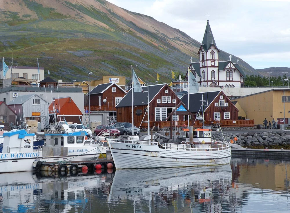 Lųnvibyg 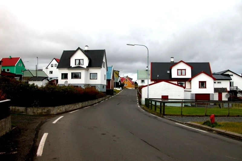 Eymųndstaðr | |||||||
| 2 | Eymųndstaðr | 2,399 | ||||||||
| 3 | Sigrųnabræðja | 1,817 | ||||||||
| 4 | Odinshąðn | 1,098 | ||||||||
| 5 | Eybræðja | 998 | ||||||||
| 6 | Þellvrønnr | 976 | ||||||||
| 7 | Hørðbræðja | 233 | ||||||||
| 8 | Ǫflegrstaðr | 132 | ||||||||
| Based on the 2014 Census | ||||||||||
Politics[]
Government[]
Military[]
Foreign Relations[]
Administrative Divisions[]
Economy[]
Joland has a relatively free market economy, however due to the country's small size, population and level of economic diversity, many of the economic sectors of the island are either state owned or monopolised, such as Banking, Energy, Media and Transport on the island. The island has a total GDP Purchasing Power Parity of $350 Million, and a GDP (PPP) Per Capita of $30,769. The United Nations has repeatadly labelled Joland as one of the most developed nations in the world in terms of high income equality, GDP per capita, social mobility and various others. The unemployment rate on the island is less than 1%. The island's welfare system provides Healthcare, Education (including University) and various allowances to every citizen of Joland. Like other welfare states, taxpayers pay various subsidies to each other, but with spending being less than in most European countries.
The island has higlhy agrarian economic values. Joland's economy has almost always dependent on its main industry, Fishing. Fishing makes up for around 50% of the island's exports, and employs around 23% of the island's workforce. This high dependance on fish stocks, can lead to island's economy fluctuating in relation to the amount of fish in the waters around the island. Fishing is so important on the island, that is had been one of the main reasons against joining the EU, which would mean the loss of control of the island's fish stocks.
The currency of Joland is the Jolandic Krǫna (JLK). The Krona is pegged with the Icelandic Krona and share a common exchange rate between other currencies. The Jolandic Krona is issued by the Eysbąnki, the only Jolandic bank. Currently, the exchange rate between the Jolandic Krona and the Euro is 157JLK to 1 Euro. The Jolandic Krona was grealty affected by the Icelandic economic collapse.
The island's economic centre is located in Lųnvibyg. There has been high diversification in the island's economy in the last few decades, with biotechnology, information technology, and finance accounting for around a quarter of economic activity by 2014. The Tourism sector is also very high, over 8,000 people visit Joland a year. A significant increase in the popularity of Whale watching, ecotourism and geography trips has led to Tourism employing just under 10% of the population of the island.
Joland produces 100% of its own energy needs domestically, using the island's single Geothermal Power Plant, which taps into the geothermal spring underneath the centre of the island. Joland produces roughly 60% of its own food needs, with over 40% imported from Europe.
.
Infrastructure[]
Transport[]
Joland has a very modernised transport system for a nation of its small size. Joland has a high level of car ownership per capita, with roughly 593 vehicles per 1000 people. Citizens must either specially import vehicles to the island, or purchase them at one of the islands three car dealerships. Vehicles are taxed on the amount of Carbon Dioxide they produce, however many people accept high taxes for large vehicles as they are necessary for getting around the island during Winter.
There is over 120 km of paved streets on the island. The main road, the Island Ring Road, or Hringavęgr, also called Route 1, circles the island along its coastline connecting all of its districts and settlements together. The fully paved road was completed in 1953. The only other major road on the island is Route 2, which runs across the north of the island connecting the coast to the inland Geothermal Powerplant and the Jolavellgąðr National Park in the uninhabited interior of the island. It takes roughly an hour to drive around the entire island once. There is a regular hourly bus service operated by JolBųs a state owned company, which runs both Clockwise and Anticlockwise around the island.
The main way of getting into Joland, is the International Airport, located in the Sigrųnabræðja District in the south east of the island. The airport provides regular flights to Europe, mostly Scandinavian countries, and Iceland. Joland's national airline, Jolandair, was formed in 1968, and became the flagcarrier in 1980.
Energy[]
Joland provides 100% of its own energy needs domestically, from entirely renewable sources. The island's only powerplant, the Jolavell Geothermal Power Plant was constructed in 1956, replacing the old Coal Power Plant which was closed and demolish. The Geothermal Power Plant employs roughly 5% of the population, making it one of the largest single employers on the island. The powerplant taps into the Geothermal Spring underneath the island caused by the Jolavell Volcano. Formerly, there have been proposals to increase the amount of electricity produced on the island, by the use of wave generators.
The energy sector in Joland is entirely state-owned, and managed by Landsotferði. The fully state owned company is answerable to the government of the Joland, and is also responsible for the management of fuels on the island, managing all petrol stations and domestic energy supply and utilities on the island.
Healthcare[]
Education[]
Science and Technology[]
Media[]
Media in Joland is diverse for a nation of its small size. There is one daily newspaper, Dagrfręttr and one weekly newspaper, the Eyfręttr. In addition, there are several periodicals on the island, including Eyþenðans (Island Culture) and Tiðąrið.
The public broadcaster, Rįkisonvarði (RSV) is 100% owned by the Jolandic governemnt, and broadcasts two radio stations, Ųtvarð 1 and Ųtvarð 2, and one television channel, Sonvarð 1 (TV1), commonly known as Channel 1. Channel 1 reaches every home on the island and broadcasts a mix of cultural programming, news, and entertainment including important programming. Other than the public broadcaster, there is one other domestically produced television channel, Þver2, which mostly broadcasts imported programming.
Demographics[]
Population Statistics[]
As of 2014, the total population of Joland is 11,365, and the island has a population density of 240/km, over 47 km squared. The GDP Per Capita of Joland is $30,769, and the average monthly wage is $3,876. The island has an umemployment rate of less than 1%, and less than 1% live below the poverty line.
The island has a fertility rate of 1.9, and a death rate of 11.17 per 1000. Most families opt to have one child, who usually stays at home until after University. Literacy Rate exceeds 100%, and over 65% of the population have achieved the equivalent of a Bachelors Degree due to the nature of free university education on the island, leading to a highly qualified workforce.
99% of the population of the island are native Jolandic people. The second largest ethnicity on the island are Danish People, who make up 0.4%, followed by Icelandic at 0.2% and British at 0.1% followed by lastly Polish at 0.1%.
Language[]
The official language is Jolandic, following the Act of Parliament in 1995. Jolandic is a North Germanic Language, closely related to both Icelandic and Faroese. It is a descendant of the Old Norse Dialect spoken by settlers on the island after the 8th century. Due to the island's relative isolation, the language has not evolved greatly from its Old Norse roots.
Following Jolandic, the second most spoken language on the island is English. Over 70% of the population claim to be able to speak English fluently, however English is only used by roughly 8% of the population in daily life. After English, the second most spoken non-native language is Danish, spoken by 14% of the population. Schools on the island are required to teach two foreign languages, and many teach three. The most common foreign languages taught are English, Danish, German, and Mandarin.